↑ Return to Journal
Itineraries
Mt. Arayat Day Hike Itinerary
ITINERARY MT. ARAYAT DAY HIKE MAGALANG-NORTH PEAK 0500- 0700H. Ex. QC EDSA-Quezon Ave. to Magalang Municipal Hall on own vehicles, via NLEX, exit Dau or Angeles. 0700- 0730H. To DENR at Bgy. Ayala. Register, secure guide, porter as needed. 0800- 0930H. To White Rock. By-pass WR recommended. 0930- 1100H To North Peak, PNP station. Lunch, …
Mt. Pulag Itinerary
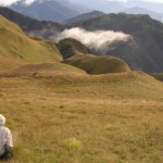
PULAG via AKIKI-AKIKI GENERAL: Mt. Pulag, located in the Cordillera Mountain Range of Northern Luzon, is at the tri-boundaries of the provinces of Ifugao, Nueva Vizcaya and Benguet. At 2,922 meters (9,610 feet) elevation, it is the highest peak in Luzon and the second highest peak in the Philippines. For the natives of …
Isla Verde Itinerary
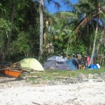
ISLA VERDE, BGY SAN AGUSTIN KANLURAN GETTING THERE and BACK COMMUTING VIA PUBLIC TRANSPORT: NOTE: Bus terminals are in the Cubao, Quezon City area along EDSA; Taft Avenue – Buendia Avenue area in Pasay City; Alabang South Terminal in Muntinlupa. Bus lines: Jax, Jam, DBLTB, ALPS, Dela Rosa, others. TRAVEL TIME- Two-and-a-half to three hours …
DUEG Itinerary
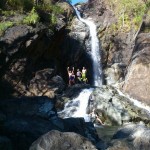
DUEG OUTREACH GENERAL ITINERARY General notes: The outreach is preferably done on the second day of a two-day schedule. This would allow the trek to Timangguyob Falls to be done more leisurely on D1. It should not be scheduled during semestral, Christmas or summer breaks to better assure availability of teachers to assist in …